TERKINI SATELIT CHINA RAKAM IMEJ BERKEMUNGKINAN??

Rakaman setelit yang dirakamkan sehari selepas kejadian kehilangan pesawat #MH370 ini menunjukkan ada serpihan di Laut China Selatan antara Vietnam & Malaysia.
Baca berita di bawah.

CHINESE SATELLITE IMAGES MAY SHOW CRASH SITE OF MISSING MH370 FLIGHT
The Chinese Government, via their State Administration of Science, Technology and Industry for National Defense department (SASTIND) have released what appears to be 3 floating objects that are suspected to be parts of the missing MH370 flight that went missing on 8th March.
The released images, which were captured on March 9th show three large objects floating, with the largest object being measured at 24×22 meters. The Chinese Agency have released the coordinates of 105.63 east and 6.7 north, which would put the aircraft on its intended route from Kuala Lumpur to Beijing before it disappeared.
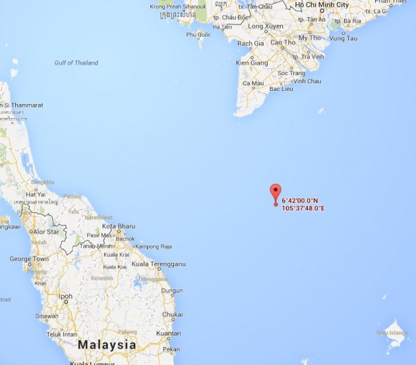
The large size of the objects, and the location are so far the best lead in the frustrating 5 day search for the missing plane. It also tallies with an eyewitness report that was circulating earlier today where an oil rig worker off the coast of Vietnam reported seeing a burning plane in the sky on the night flight MH370 mysteriously disappeared.
Sumber mazeermohamad.com
Categories:
Latest Post,
Utama


0 comments:
Post a Comment